FieldSight by Great Lakes SiteLogic: the jobsite, in your hand.
Phone-first field mapping that puts your live position on the plan — plan import (DXF, LandXML, PDF sheets), CAD-grade editing in the field, stakeout, and multi-brand GNSS, built for every trade on the project — plus a built-in field book of material lists, pipe size tables, and jobsite calculators. One app, one subscription — the plan viewer, the field GPS, the markup tools, the calculators, and the crew messaging a job usually pays for separately. Works with Trimble. Works without it. Now at version 1.7.93, in closed beta on Google Play.
FieldSight
Put the right information in the hands of the people doing the work. FieldSight brings the plan, your live position, and the crew's marks into one workspace, so the site makes sense while you're standing on it. Watch the full walk-through:
Version 1.7.93 Closed Beta — Google Play
Built for practical site workflows.
FieldSight reduces the gap between the office, the model, and the field — turning disconnected files and location data into a clearer jobsite view.
FieldSight is phone-first: import the plan and your live position rides on it, so the crew sees where they're standing relative to the design — not a pin dropped on a street map.
Bring in DXF, LandXML, KML, GeoJSON, CSV points, or PDF plan sheets. DXF arrives with its layers and text placed in position at true height — tap any imported feature to edit it. Nothing comes in as a dumb picture.
Drag and node-edit linework with live reshape and snapping, and work with Measure, Offset, 3-point arcs, Join, Break, Close, and line-by-length tools — plus Rotate any line or shape around its center, Duplicate a feature with every one of its stamps intact, per-layer colors and line styles, text labels, and full undo/redo.
Use the phone GPS, plug in a Trimble SPS986 or R780 over USB, or pair an Emlid, Bad Elf, or Ardusimple receiver over Bluetooth — with NTRIP corrections and a live fix-quality readout.
Two ways to work the job: Map view for the live plan, and Sheet view for reading PDF plan sheets full-screen. Calibrate a sheet Bluebeam-style — draw over the scale bar or type the printed scale — then measure distances, paths, and areas right on the sheet in real units.
FieldSight's third view — the Reference tab — puts the book a foreman usually keeps in the truck right in the app: standard material lists, pipe size tables, a feet-and-inches converter, jobsite calculators, hauling weights, and coverage figures. No signal needed, no separate app, no calling the office.
Standard lists for the crews who order the work — earthwork and aggregates, pipe and drainage, concrete, paving, erosion control, and restoration — each item with its typical sizes and how it's sold. Fill dirt spelled out, too: clean fill, screened fill, structural fill, and clay fill.
Inside and outside diameters by pipe type — SDR35, Schedule 40, HDPE dual-wall, RCP, ductile iron, and CMP — so the size on the plan is the size that fits the trench, the tap, and the structure.
Convert feet-and-inches to decimal feet and back, down to sixteenths of an inch, with quick charts and the grade-rod readout in tenths and hundredths — the numbers read the way the rod reads.
The volume estimator keeps the two yardages straight: enter the finished size and it returns placed, compacted yards, the loose truck yards to haul and order, and the weight — per material, dry or wet. Concrete yards, asphalt tonnage, trench excavation, bedding and backfill, stockpile cones, and yard-to-ton conversions live in the same toolbox.
Sloped volumes figured properly — bottom size, depth, and side slope in, true volume out — for ponds and borrow pits, with spoils to truck, capacity in gallons, and liner area. Berm mode returns compacted yards in place and the loose yards to bring in.
Every haul material with its dry and wet weight per cubic yard, plus a load calculator that totals a truck, flags a load over your payload cap, and counts the loads in a job — because wet sand is the classic overload.
How much ground a yard covers, and how much a ton covers, at your spread depth — for every haul material, dry and wet — with a calculator that turns an area into the yards and tons it needs.
The Measure tool now closes an area: tap the corners on the map and the readout adds the enclosed square footage — then send it straight into the calculators, where the yardage and tonnage are already figured.
Stake points and lines with live distance and direction guidance, and read CUT/FILL against design grade as you close in — no separate staking app, no paper grade sheet.
Pick your trade — civil, landscape, demolition, forestry, electrical, plumbing, erosion control, or general — and get the tools, line types, and symbols that trade actually uses, from APWA utility colors to timber-cruise plots and demo hazard marks. The erosion control toolbox marks 20 measures — silt fence to sediment basins — and stamps a condition on every one; forestry tallies tree removals by size class, saved right into the job record.
Trace right-of-way lines, curblines, edge of pavement, lane markings, sidewalks, crosswalks, driveways, medians, and turn arrows over high-resolution satellite imagery — with areas for parking lots, ADA ramps, pavement patches, removal limits, restoration, shoulders, ditches, staging, and easements — then download a to-scale, layered DXF basemap in state plane feet that opens in CAD at real-world scale. Reference linework for planning and layout — not a survey.
Drop real NGS benchmarks on the map for control you can trust, toggle a Buildings footprints layer to stay oriented on developed sites, and check the federal wetlands reference layer before planning work near wet ground.
Export points and linework as GeoJSON, KML, GPX, DXF, or CSV — elevations carried through — for CAD, GIS, Google Earth, and reporting.
Save the job to the cloud and the whole crew works from the same site: shared files, and a live updates feed so everyone sees new files, field marks, and changes the moment they're posted.
Every organization gets a message board, and every job site gets its own — post a note with a title, thread replies under it, or keep a post private. Direct messages keep one-to-one conversations inside the organization instead of buried in personal texts — and push notifications reach the crew even when the app is closed: site invites, messages and replies, uploads, and changes on shared jobs, each kind switchable per device.
Invite another organization, like a subcontractor, into a single job site for 7, 14, 30, or 90 days. They see that site's files, updates, and notes — nothing else — and access expires on its own, or the moment you revoke it.
A plan viewer, a field GPS/GNSS app, markup and stakeout tools, material and takeoff calculators, and crew messaging — a crew usually carries those as separate apps, on separate subscriptions, that don't talk to each other. FieldSight folds all of it into one app: the plan, your position on it, the math, and the conversation live in one place, on one bill.
Three view tabs up top — Map, Sheet, and Reference — and a Tools ribbon with Map, Sheets, Data, Find, and Options, plus Account, Import/Export, Toolbox, and Layers in the sidebar. No menus to dig through — every tool lives where you'd look for it.
Critical site information shouldn't be stuck in the office.
The jobsite moves fast, but key information is often trapped inside a CAD file, buried in a text message, or spread across disconnected tools.
FieldSight was built to close that gap. The focus isn't technology for its own sake — it's giving crews a straightforward way to see where they are, understand what's around them, and make better field decisions.
FieldSight is actively evolving through real-world construction feedback, with the goal of a dependable workflow for importing project information, reviewing it in the field, and improving office-to-field communication.
See FieldSight in action.
Real screens from the app — the trade toolboxes, GNSS panel, and map views your crew will use every day.
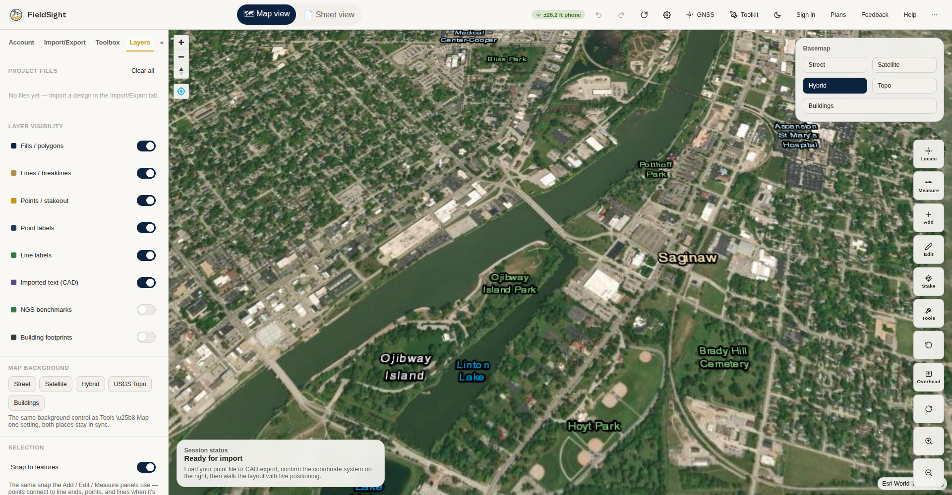
Live position on the plan with satellite basemaps and a Buildings footprints layer. Layers live in the sidebar; the Tools ribbon carries Map, Sheets, Data, Find, and Options.
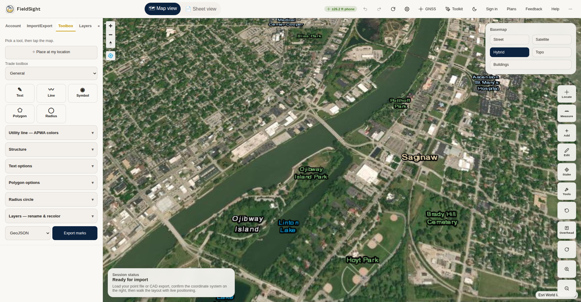
One tap switches the whole toolkit — civil, landscape, demolition, forestry, electrical, or plumbing — each with its own tools and presets.
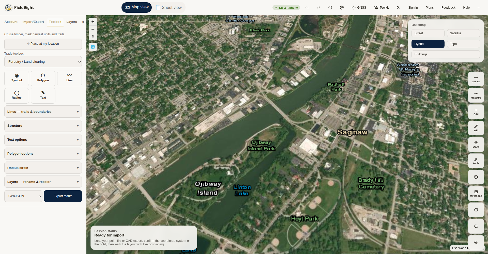
Skid trails, harvest boundaries, stream buffers, and tree, snag, and landing marks for timber cruising and land clearing.
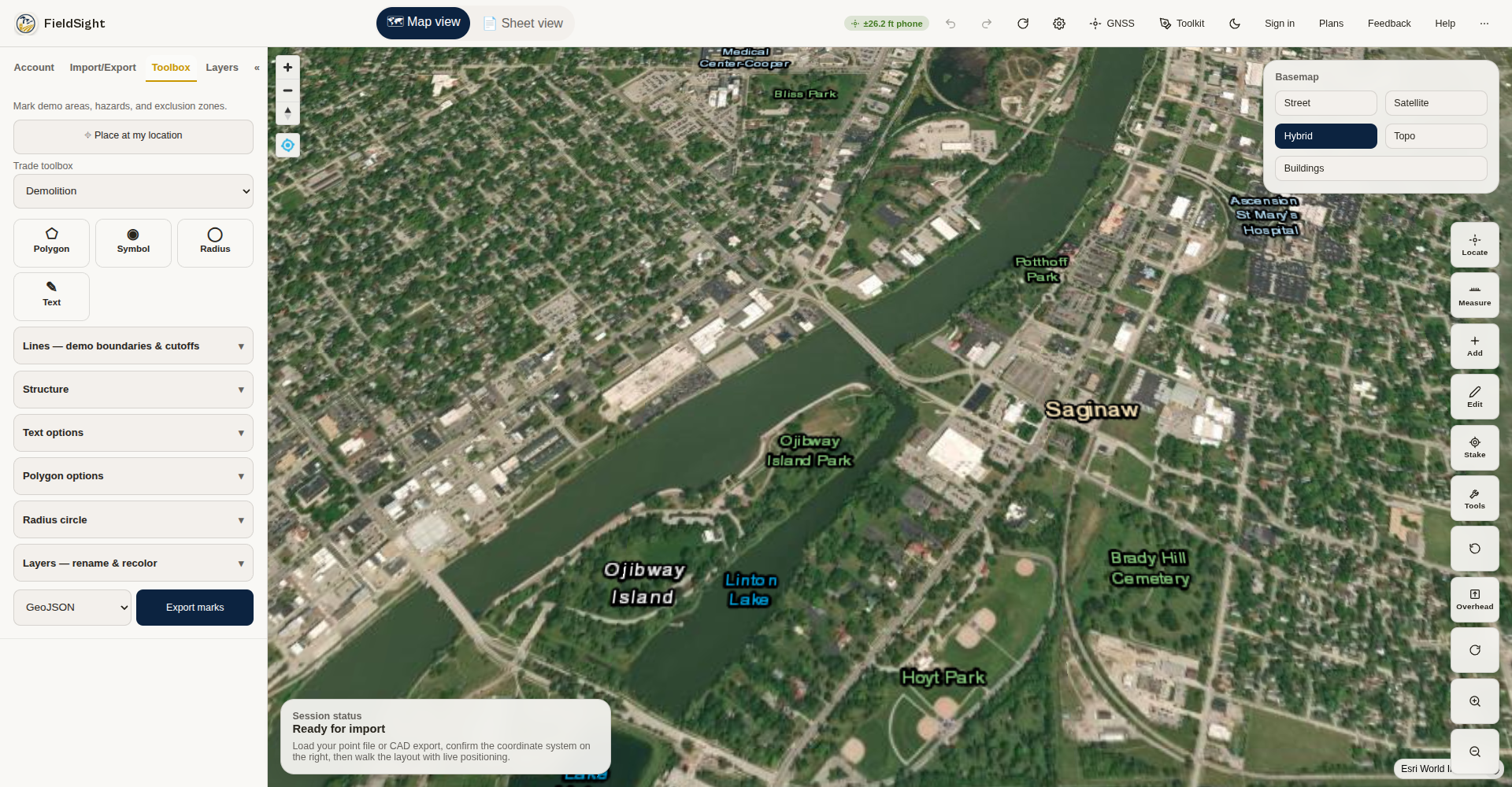
Demo boundaries, cut-and-cap lines, haul routes, plus ACM and lead hazard marks, debris piles, and exclusion-zone circles.
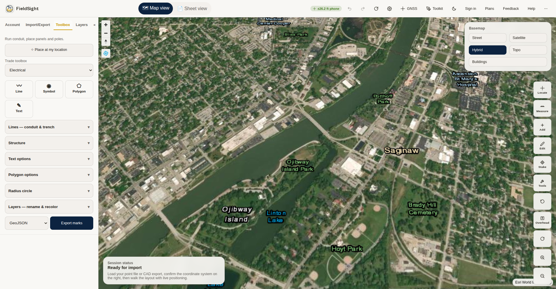
Primary and secondary runs, trench lines, and panels, transformers, poles, light poles, junction boxes, and meters.
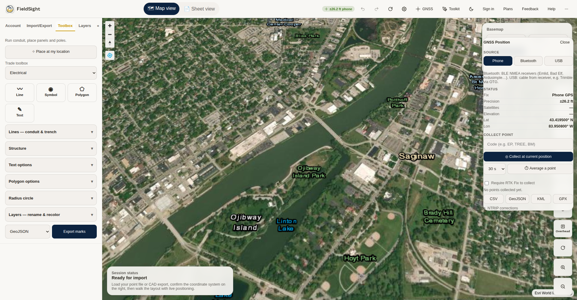
Phone, Bluetooth, or USB receiver with live fix-quality readout, point collection, and NTRIP correction settings.
Now testing with contractor crews.
FieldSight is in closed beta on Google Play, and we're recruiting contractor testers — run it on real jobs and tell us what breaks. When it opens up, pricing is simple, and every plan starts with a 14-day trial.
Solo
$29/mo
For the one-person operation putting its own plans in the field.
Crew
$49/user/mo
For crews sharing job sites, files, and live updates across the team.
Company
$99/user/mo
For companies standardizing field mapping across every crew they run.
Ready to talk about your project?
Local support in Saginaw, Bay City & Midland. Remote support statewide.